Agentic Geospatial Intelligence
Accelerate decision-making with the first autonomous GEOINT agent. Transform overhead imagery into traceable, survey-grade accuracy intelligence using natural language and vision primitives
See How It WorksIntelligence at Scale
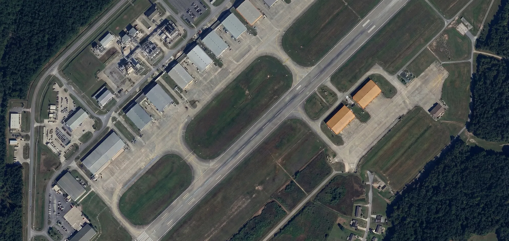
Overhead imagery workflows face persistent constraints that limit operational effectiveness
Overcome Scale Mismatch
Automated detection handles massive imagery volumes that exceed human capacity, freeing analysts for high-value interpretation
Rapid Time-to-Answer
Replace repetitive micro-tasks with instant workflows, from single tool calls to full agent-run missions
Auditable Integrity
Direct operation provides precise results you can validate step by step. Agent execution provides conclusions with traceability from source imagery to final measurement
How It Works
Two integrated layers power autonomous geospatial intelligence
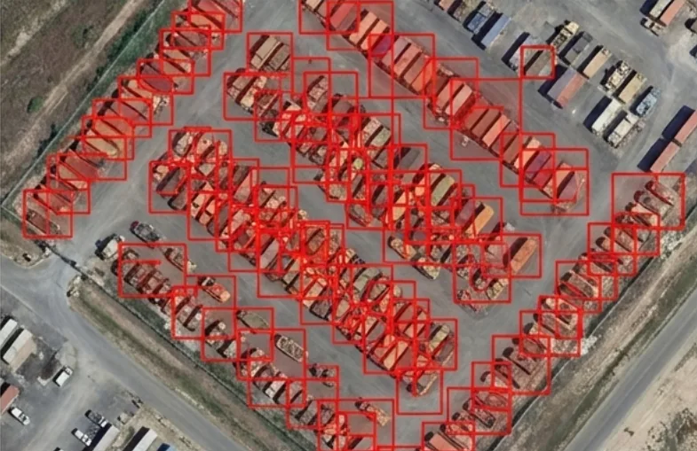
GIS-Ready Precision
Built for overhead views. Deliver instance-level segmentation for reliable counting in dense scenes, accurate area computation, and outputs that drop directly into GIS workflows
- Per-instance masks for GIS layers
- Reliable counts in dense scenes
- Measurement-grade precision
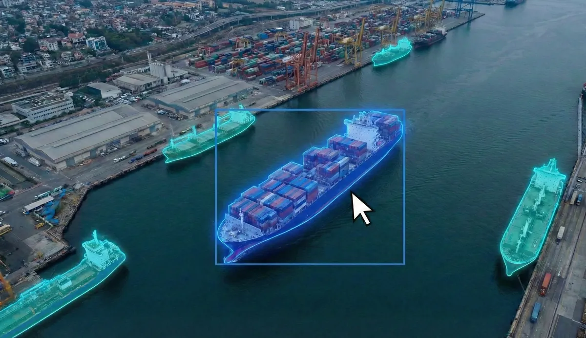
Autonomous Investigation
The Agent performs multi-step investigations. It correlates observations across discontinuous time using visual similarity and context cues
- Multi-step reasoning chains
- Cross-time correlation
- Evidence-backed conclusions
Multi-Modal Querying
Multiple ways to specify your intelligence requirements
Natural Language
Describe targets and conditions in plain English. The system interprets intent and executes appropriate detection workflows

Photo Example
Upload a reference image of a specific target type. The system searches for visually similar assets across your imagery
Map Selection
Click directly on objects in your AOI to designate them as reference examples for similarity search
Ready to Transform Your GEOINT Workflow?
Join our early access program and be among the first to experience autonomous geospatial intelligence
Get Early Access